As significant events unfold around the world, Geospatial eXploitation Products™ (GXP™) software delivers the most advanced geospatial intelligence through rapid discovery, exploitation, and dissemination of mission-critical data to those who need it most.
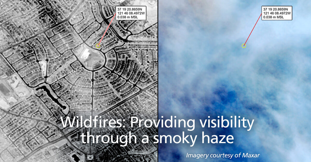
Over the last several weeks, extensive wildfires have devastated the West Coast of the United States, endangering both people and infrastructure while clouding the sky with a thick blanket of smoke. As firefighters and other emergency personnel respond to those in need, GXP multi-spectral analysis can be applied to Maxar satellite imagery to see through the smoky haze and provide much needed visibility into the terrain below, alerting authorities to the continued presence of fire and the extent of structural damage.
For further information about geospatial software from GXP, or to request a virtualized instance of SOCET GXP for trial, please don’t hesitate to contact GXP Support at gxp.support@baesystems.com or 800-316-9643.