SOCET GXP® Spatially Enabled Exploitation
Mobile Apps
Spatially Enabled Exploitation (SEE) allows users the ability to work with feature geodatabases and a wide variety of geographic information systems directly inside the SOCET GXP® Multiport™.
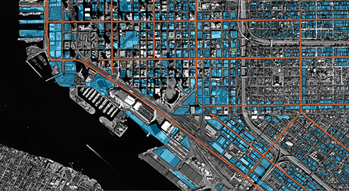
In order to best understand an area of interest, it is imperative to be able to visualize foundational information regarding a location including infrastructure such as power lines, roads, buildings, and more. In addition, there is a need to be able to historically analyze a scene to see how things have changed over time. Feature databases allow users to accomplish these goals and more ensuring that intelligence is not left on the production floor, but rather usable for future needs.
SOCET GXP users can take full advantage of feature geodatabases and geographic information systems by utilizing the SEE module. Analysts are able to directly connect to a wide variety of feature databases directly in the SOCET GXP Multiport including multiple types from Esri® (file, personal, multi-user) and PostGIS. Once connected, users can collect features, apply attribution, and change symbology related to any feature class. The advantages of utilizing the SOCET GXP Multiport include precision accuracy in all three dimensions for the features as the rigorous sensor model information is used. Collection in both mono and stereo Multiports is possible with a wide variety of drawing tools which allow for efficient collection of even complex 3-D features directly into the feature database. Attributes can be automatically populated from metadata associated with the imagery being used for feature collection thus reducing the amount of information that must be manually input by a user.
In addition to collecting directly into a geodatabase, the SEE module allows users to connect to and work seamlessly with the Portal for ArcGIS® Pro and ArcMap® by Esri. This connection forms a geospatial link between the SOCET GXP Multiport and either ArcMap or ArcGIS Pro. Analysts can navigate in either application and ensure their view extents stay matched. In addition, users can extract or modify features in either application and have the changes update dynamically in both places. Symbology changes are reflected as well.
The SEE module also includes the ability to publish products created in SOCET GXP software directly to the Portal for ArcGIS by Esri.. This allows for efficient and rapid sharing of products that can easily be accessed by others across a user’s enterprise. Analysts can include optional basemaps in their products as well as local imagery that can be published using the advanced GXP Xplorer® pixel streaming functionality.
The Activity Reporting Tool (ART) is also included in the SEE module. For more information on ART, click here.