GeoPDF® for SOCET GXP
Mobile Apps
GeoPDF® Software
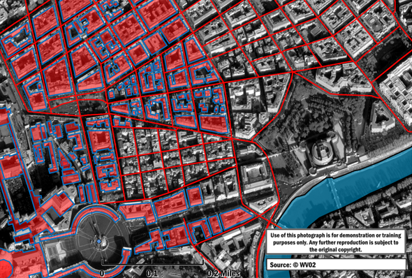
SOCET GXP is capable of creating both 2D and 3D GeoPDF products. These geo-referenced PDFs are viewable by any user with Adobe® Acrobat® Reader® with the free TerraGo® GeoPDF Toolbar plugin.2D GeoPDF products
TerraGo 2D GeoPDF Publisher for SOCET GXP allows for the creation of georegistered PDF files (GeoPDFs) from data loaded in a SOCET GXP Multiport. Different feature and data layers can be toggled on and off in the resultant GeoPDF product to allow for quickly filtering between relevant data.
3D GeoPDF products
TerraGo 3D GeoPDF Publisher for SOCET GXP allows publishing of terrain, imagery, and feature data into a 3D GeoPDF directly from the SOCET GXP application. 3D GeoPDF files allow users full navigation of the resultant scene in all three dimensions allowing for true situational awareness and multiple viewpoints.
The Benefits of GeoPDFs
Adding value to GXP® workflows, GeoPDFs are interactive and easy-to-use products that can be shared with any end user including those on mobile devices. GeoPDFs can be freely viewed with Adobe Acrobat Reader. These products retain geographic coordinate information and thus are inherently more valuable than a standard PowerPoint® slide or JPG file as they allow users to identify coordinates of items of interest and make measurements directly on the GeoPDF.
Other benefits include:
- Interact with imagery and location-based analysis
- Share with users on any devices including phones and tablets
- Measure length and area; display and locate coordinates
- Preserve data layers and toggle layer visibility
- Create and share location-based observations
TerraGo GeoPDF Toolbar
The GeoPDF Toolbar can be downloaded for free and allows users to view and track coordinates across the product, calculate measurements, create geospatial mark-ups, track real-time positions using GPS, and more.
Learn more: